Great Lakes Ecology Solution Proposal

Wildlife-Friendly City Design

Protecting wolves and deer by reducing habitat fragmentation in the Great Lakes region

Fragmented Habitat Changes Predator and Prey Behavior

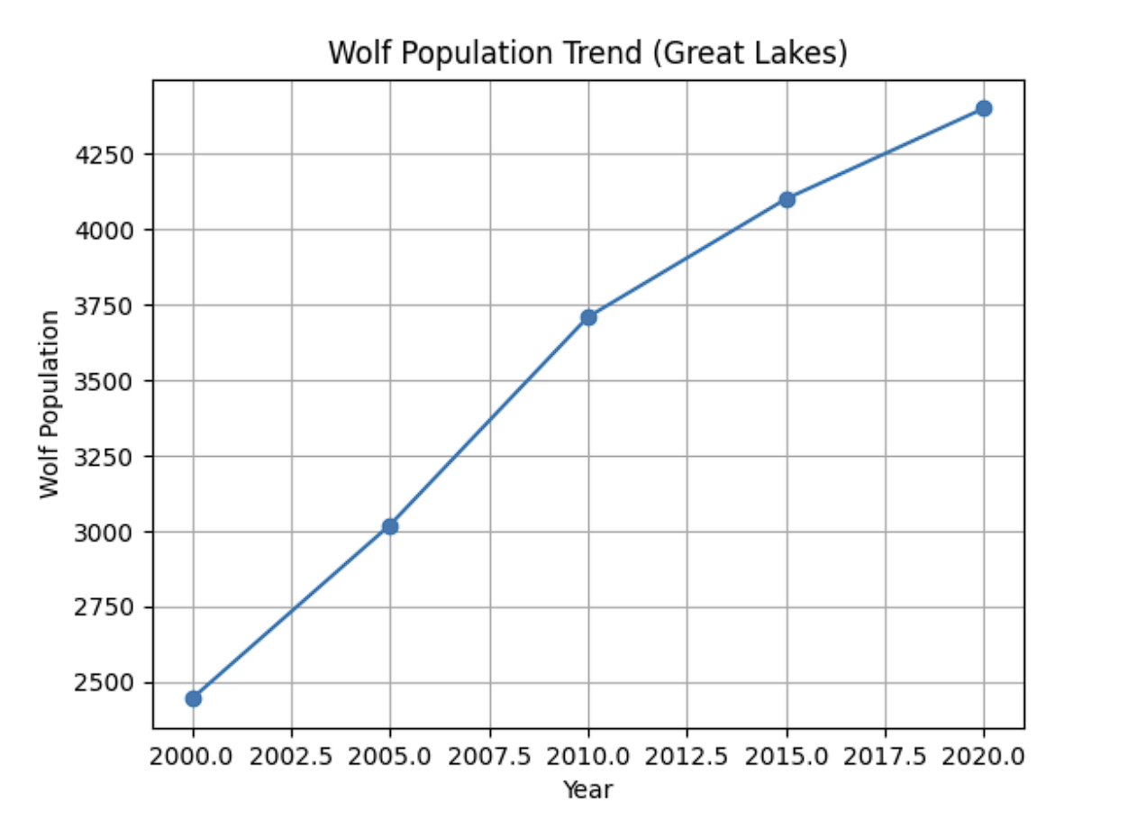
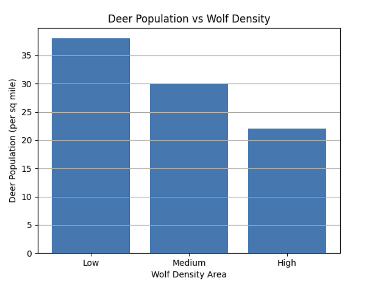
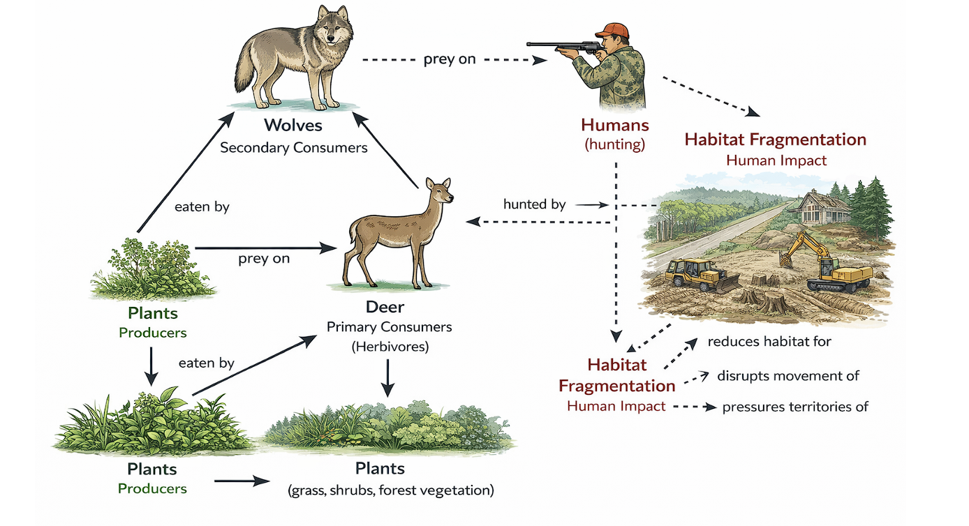
In the Great Lakes region, forests, wetlands, roads, farms, and towns overlap with habitat used by wolves and deer. When development breaks large habitats into smaller patches, deer often concentrate near yards, roads, and forest edges, while wolves must travel farther through risky human spaces to hunt and maintain territories.

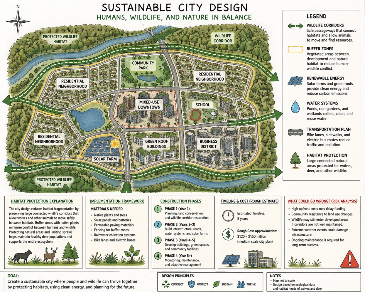
This creates more wolf-deer conflict and more human impact: vehicle collisions, pressure on native plants from high deer density, possible wolf-human encounters, and weaker connections between wildlife populations. A sustainable city can reduce these effects by protecting core habitat while guiding development into less sensitive areas.

Rules That Protect Wildlife Space

  • Land use limits: keep new construction away from the most important forest, wetland, and denning areas.
  • Buffer zones: create zoning buffers between buildings, roads, and high-value wildlife habitat.
  • Wildlife protection laws: reduce disturbance, illegal feeding, and habitat damage near protected corridors.
  • Transportation rules: require wildlife crossings, fencing, and road designs that lower collision risk.

Major Investment Areas

Infrastructure High
Renewable Energy Medium/High
Habitat Protection Medium
Monitoring Ongoing

The total cost would likely reach the hundreds of millions of dollars, depending on city size, land prices, road upgrades, energy systems, and long-term wildlife monitoring.

Swap-Ready Evidence Slots

Wolf population graph
Deer vs wolf density graph
Food web model
Food web model
City design layout
City design layout

Five-Year Rollout

  1. Phase 1 Year 1: Planning + habitat protection

    Map sensitive habitat, protect core areas, collect baseline wolf and deer data, and set zoning priorities.

  2. Phase 2 Years 2-3: Infrastructure

    Build roads, utilities, renewable energy systems, crossings, fencing, and stormwater systems around protected areas.

  3. Phase 3 Years 4-5: Buildings + corridors

    Add housing and business zones while preserving green corridors that connect forest patches and wetlands.

  4. Phase 4 Year 5+: Monitoring

    Track wildlife movement, roadkill, habitat health, and community feedback, then adjust the design over time.

How the Design Will Be Tested

  • Wolf monitoring

    Use camera traps, GPS collars, and field observations to track movement through corridors.

  • Biodiversity indicators

    Measure native plant recovery, prey balance, and the presence of other wildlife species.

  • Habitat connectivity

    Compare movement data before and after corridors, crossings, and protected buffers are built.

  • Roadkill reduction

    Track collision reports and crossing use to see whether transportation changes are working.

Adaptable Beyond the Great Lakes

This city design can work in other regions if the habitat map, target species, climate, laws, and community needs are adjusted. The main idea stays the same: protect connected habitat first, then place human development where it causes the least ecological damage.

Challenges to Plan For

Cost Public resistance Wolf-human conflict Maintenance issues Weather/disasters Development pressure

The strongest risk response is long-term planning: stable funding, public education, clear safety rules, regular maintenance, disaster-ready infrastructure, and limits on development inside protected habitat networks.

Sources: U.S. Fish and Wildlife Service, National Park Service, state wildlife agencies.